Medieval Islamic Maps Exhibit Opens at Dublin’s Chester Beatty
Medieval Islamic Maps Exhibit Opens at Dublin’s Chester Beatty
——————————–
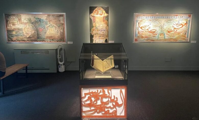
Dublin’s Chester Beatty Museum is hosting Routes and Realms – al-Masālik wa al-Mamālik, a major exhibition showcasing a rare 13th-century Arabic manuscript featuring one of the earliest Islamic world map collections, Medievalists.net reported. Central to the exhibit is a beautifully preserved copy of Kitāb al-Masālik wa al-Mamālik (“The Book of Routes and Realms”), containing 21 illustrated maps depicting regions across the Middle East, North Africa, and Central Asia. These maps uniquely reflect medieval Islamic cartographic traditions shaped by trade, politics, and culture, rather than modern geographic conventions.
The manuscript belongs to the Chester Beatty’s Arabic collection (CBL Ar 3007) and traces its origins to the 10th-century Persian scholar al-Iṣṭakhrī. Complementing the historical maps are contemporary mixed-media artworks by Dublin artist Diaa Lagan, exploring themes of borders and identity.
The exhibition runs until 7 September 2025, offering free admission alongside public tours and workshops. The Chester Beatty Museum is renowned for its diverse collections of manuscripts and rare books across cultures and eras.