Stunning Satellite Photos Reveal Great Lakes Buried in Snow

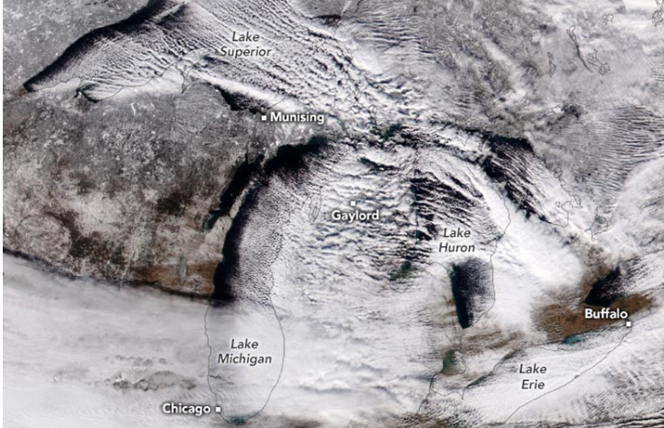
In mid-December 2024, a fierce winter storm swept across the Great Lakes region, resulting in significant snowfall and icy conditions. Satellite images captured by NOAA-21 on December 12 revealed the extent of the storm, with both natural-color and false-color views showing clouds and snow-covered landscapes, SciTech Daily reported.
The storm was driven by Arctic air moving over the relatively warm waters of the lakes, leading to intense lake-effect snow. Northern Michigan and western New York were particularly affected, with some areas receiving several feet of snow. Munising and Gaylord, Michigan, reported over 14 and 17 inches, respectively, while Elma Center near Buffalo, New York, recorded an astonishing 38 inches in just two days.
Wind gusts reached 40 miles per hour, causing wind chills to dip below 0°F across the Upper Midwest. Although the cold snap was brief, it highlighted the severe winter conditions impacting the region. Warmer temperatures returned by December 14 as the cold front moved eastward.


