New Study Finds Deforestation Raises Flood Risk by Up to 700 Percent
New Study Finds Deforestation Raises Flood Risk by Up to 700 Percent
…………
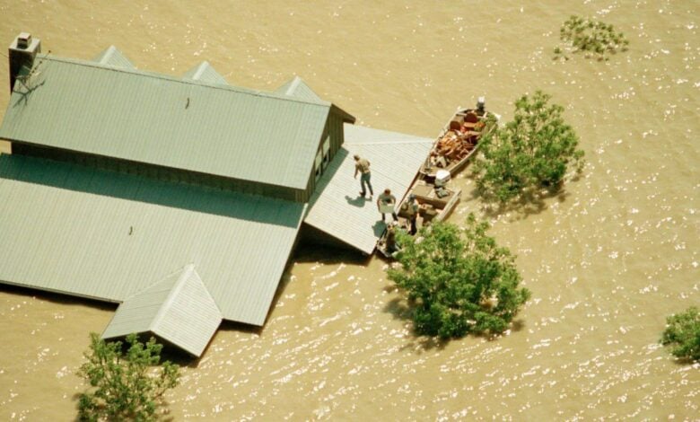
A new study has found that large-scale deforestation can increase the likelihood of major floods by as much as 700 percent, particularly in watershed regions where forests play a key role in regulating rainfall and runoff.
The research, conducted by scientists at the University of New South Wales (UNSW) in Sydney, analyzed decades of flood data from fire-prone regions in Australia. It revealed that when forest canopies are removed, the probability of severe flooding rises sharply.
According to Professor Ashish Sharma from UNSW’s School of Civil and Environmental Engineering, the likelihood of flooding can shift dramatically — from once every 64 years in forested areas to once every eight years after deforestation. The findings were based on hydrological data spanning five decades, including observations from three major bushfires in southeastern Australia.
Co-author Professor Young-Oh Kim of Seoul National University noted that forested watersheds naturally suppress flood risk — an effect lost when tree cover is reduced. “We can clearly see a buffering impact in forested catchments that disappears in deforested areas,” Kim said.
The study underscores the growing vulnerability of forests worldwide amid climate change, which has intensified wildfires and accelerated deforestation. It also highlights the dual benefits of reforestation: reducing rainfall intensity at ground level and lowering flood risk.
Trees and their canopies intercept rain, spreading water more gradually across the soil and reducing surface runoff. Leaf litter also helps slow the flow of rainfall into the ground, preventing soil saturation and lowering the chance of flooding. In contrast, when deforestation occurs, the loss of vegetation and organic cover causes rainwater to infiltrate the soil more quickly, saturating it and increasing flood risk.
Professor Sharma urged policymakers and developers to consider the findings before clearing land for human activity, noting the severe consequences floods can have on nearby communities. The study recommends stricter planning and habitat protection regulations for downstream areas affected by deforestation.
Currently, forests cover around 31 percent of the Earth’s land surface and store an estimated 296 gigatons of carbon. Yet approximately 10 million hectares of forest are cleared each year — mostly in tropical regions — for agriculture and livestock expansion.